 Chapter 4
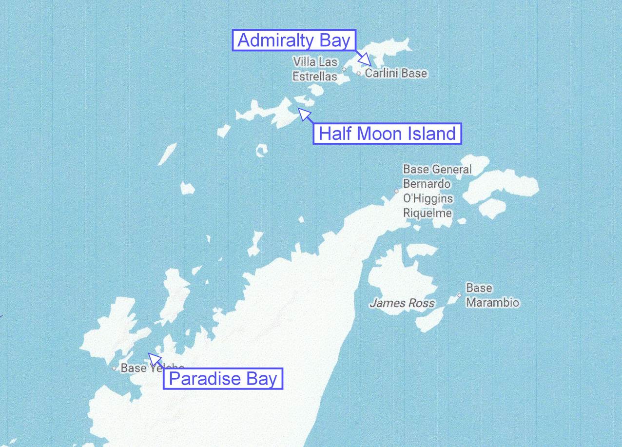
Drake Passage,
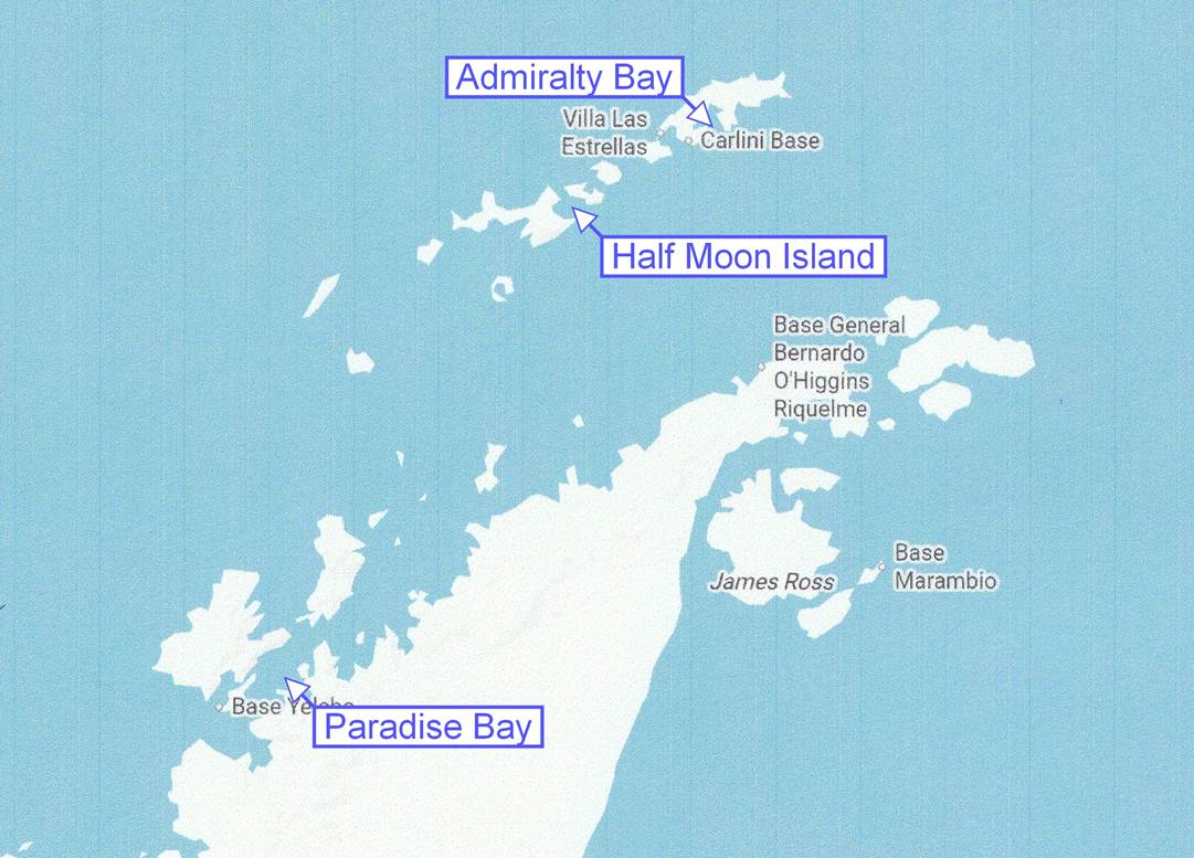
Admiralty Bay,
Paradise Bay,
and Half Moon Island
Dec. 31, Jan 1, 2, 3

At the bottom of the map
Wednesday, Dec 31: Crossing the Drake Passage
(This is going to be a short one!)
We had been warned that the Drake Passage might be rough: while the ship was moving around some, we did not think it was very bad at all, although the little white bags were again available around the ship. The weather was cloudy with occasional light rain and constant wind: you really did not want to be out on the open deck today. There were numerous activities on the ship, including several trivia contests, bridge lessons and playing, casino lessons, and three presentations in the enrichment series. We attended two of the presentations about “The Great Albatrosses” and (take a deep breath) “Geology and Paleogeography of Antarctica and Gondwana”. After these two interesting subjects, we skipped the session about sealing and whaling in the area..
The ship was decorated for the holidays, of course, and for today the crew had set up an archway of balloons in front of the grand staircase with signage welcoming in the new year. Guests could get their photos taken in the arch, celebrating the new year and remembering where they were at the start of 2026.

Decorations set up for “Welcome 2026” photos
I had not slept well the previous night, so a lightweight day was fine for me. In the evening we got ready for dinner and enjoyed a glass of wine in Martinis before dining in the GDR, which was pretty busy tonight. Perhaps people had come here to welcome in the new year. As everyone entered the GDR, they were offered party hats, shiny tiaras, and noisemakers. Thankfully, the noisemakers stayed mostly quiet during dinner.

The Grand Dining Room was busy.
After dinner we had some time before the evening entertainment, so we went up to the Horizon Lounge for our glass of cognac and got a bit of a nasty surprise. The large windows that look out over the bow of the ship had “something” on them, so we took a closer look. ICE! There was ice falling onto the windows and slowly sliding down. About this time the captain announced that we had officially entered the Antarctica region, defined by the area south of the 60 degree south latitude line. I guess the ice was just an appropriate welcome to Antarctica.

That “stuff” on the windows is ice!
We had a new “Guest Entertainer” on board and singing tonight, Paullette Ivory. Like several Oceania entertainers we have seen, she has performed in several musicals on Broadway and in Europe and certainly would not need a microphone when performing on such a stage.

Paullette Ivory on the Marina Lounge stage
Here is a short sample of Paullette wanting to Parr-tee. After the show we called it a night and officially welcomed in the new year while sound asleep.
Thursday, Jan 1, 2026: Admiralty Bay, Antarctica

Map of the Antarctic Peninsula
While we are actually in Antarctica, I am going to structure this report slightly differently: rather than the usual “sequential, through the day” structure, this will be more by subject matter. For example, today we will first look at the ice and snow and icebergs, then we’ll look at some penguins, and finally we will take a look at the largest animals: the whales. There will be some crossover in some photos, such as penguins on icebergs, and we will be using a different map (above) with more detail on the Antarctic area. Also, in a slight change, the Antarctica sections will be based more on the photos and videos, with explanations and comments centered around the photos. So, first, some ice and snow, and a few icebergs.

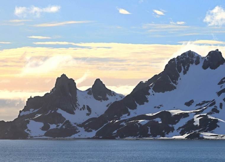
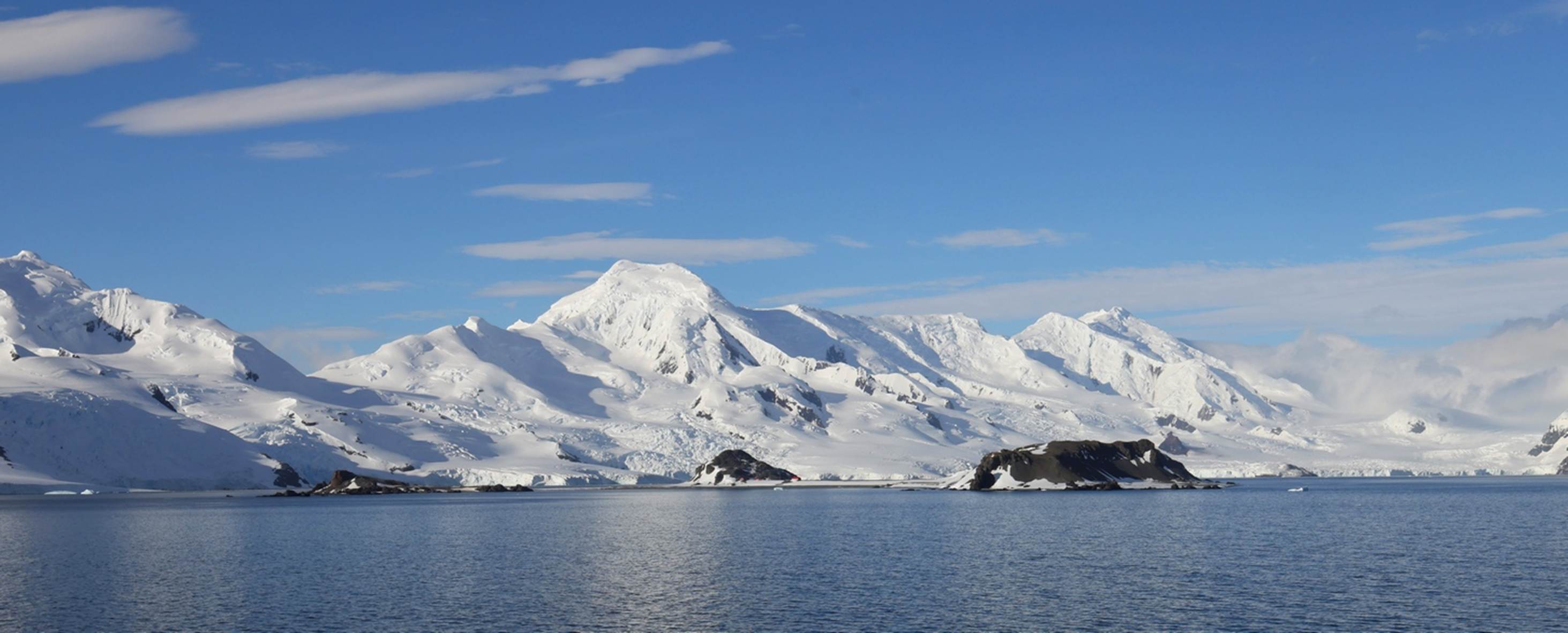
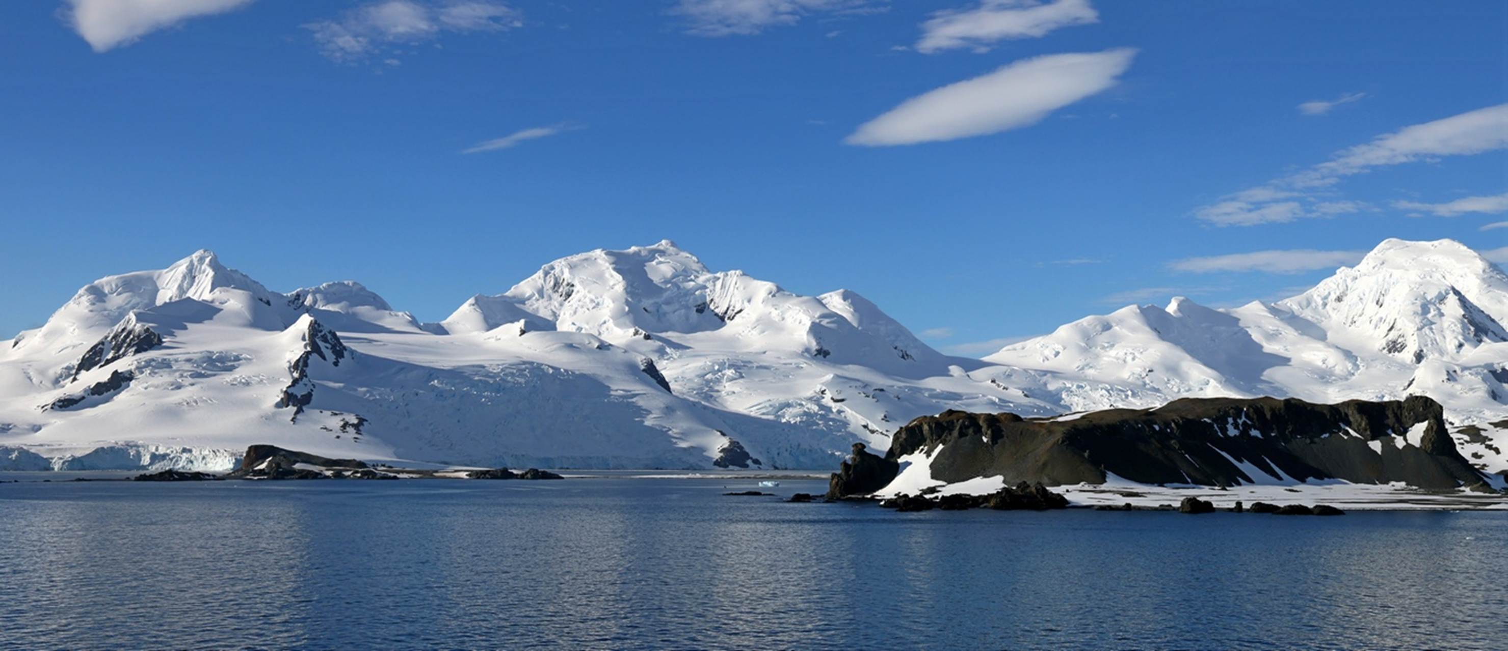
When we woke up, we were in Admiralty Bay, on King George Island, which is in the South Shetland Islands, just north of the Antarctic Peninsula. There were a lot of low clouds inhibiting the visibility but at least it was not raining and the wind was fairly calm.

Admiralty Bay is about 5 miles by 10 miles and we were about in the middle of it, with land almost all around us as the ship slowly cruised within the bay. If you want to get a peek at just what it looked like over the first couple of hours, you can view a time lapse video taken from our cabin’s balcony.

We came fairly close (maybe 100 yards) to a small iceberg that was positioned so that we could see much of the iceberg under the water. It is clear in the photo above that there is a lot more ice under the water than above.

This photo (above) and the next one were taken after we left Admiralty Bay and were out in the more or less open water. There were always a couple of icebergs in sight, but the scattering above was a bit unusual.

In the late morning and early afternoon we followed the edge of a huge ice field, at a respectable distance, of course. You can see the icefield in the distance (above) and it must have extended for 40 or 50 miles. The captain said it was unusual to see such a large ice field so far into their summer. If you look closely at the near iceberg, you can see some black dots: Penguins!

These penguins are somewhat easier to see. This morning the Antarctica experts would call out sighting of penguins and whales so we heard the call “penguins on ice” quite a few times. When calling out such sightings, the experts would use clock positions along with which side of the ship, like “Penguins at 2 o’clock on the starboard side” or “Humpback whale at 9 o’Clock on the port side”. Technically, the calling of “Starboard” or “Port” was redundant when using the clock positions, but it sounds good. For a quick look at the penguins above, but in a video, check this short penguin movie.
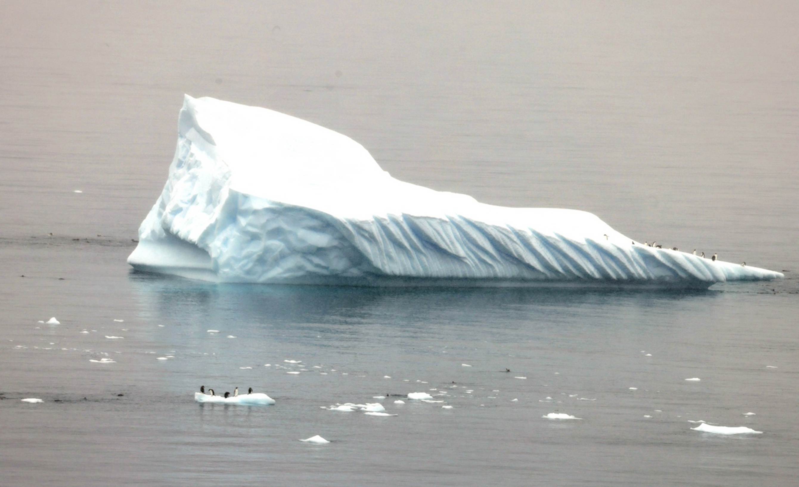
This photo (above) represents an excellent example of “the more you look, the more you see”. When you first see the photo, it is obviously of a large iceberg with some small chunks of ice around it. Oh, there are some penguins on one of those chunks of ice. And look, on the very right end of the iceberg, there are quite a few penguins. There are penguins swimming in the water at both ends of the iceberg. Penguins everywhere!

More “penguins on ice” and in the water.

This is obviously a large iceberg with a large cave in the middle of it, but check out all the penguins on the little chunk of ice much closer to us.

I grabbed this photo when I saw the whale rolling in the distance but didn’t think it would be a useful photo because the whale was so far away. When I later went back to review the day’s photos, I looked at the photo and then looked again. There are penguins in the water everywhere, on both sides of the whale! The whales and penguins do not appear to bother each other, although the penguins did seem to keep a respectable distance. These whales (mostly Humpback and Fin whales) are Krill eaters and are not a threat to the penguins. We did see one pod of Orcas (no chance for a photo) and for them, a penguin would just represent a light snack. Now, speaking of whales…. (How is that for a smooth transition?)
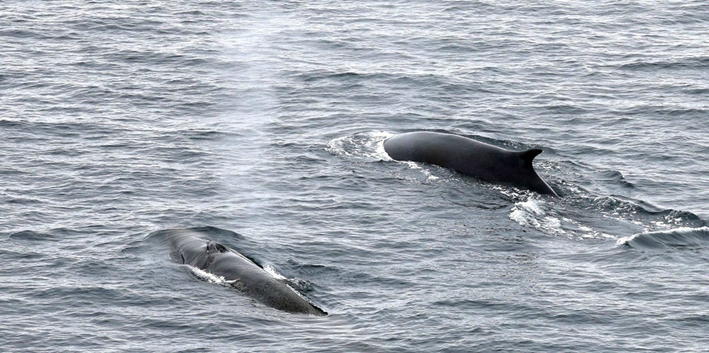
The researchers on board were interested in getting as many photos of whales diving and showing their tails (flukes) as they could. Whale flukes are almost as useful as human fingerprints in identifying specific individuals because of their different shapes and any cuts or missing chunks.

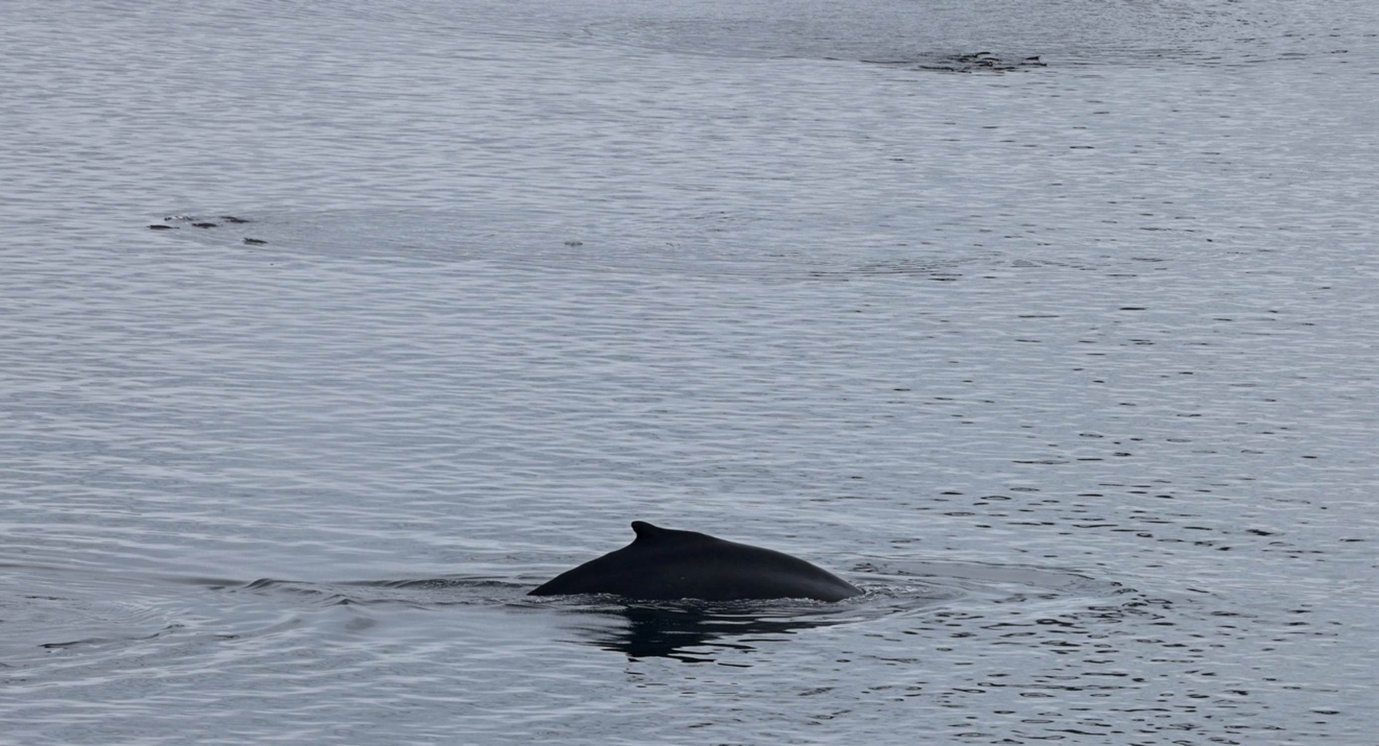
This (above) is about all we ever saw of the whales (with one exception tomorrow). The head would come up to exhale and breath, then they would roll into a dive and sometimes show their flukes, indicating this was going to be a fairly deep dive. There were no breeching or jumping whales here: they were seriously going about their business of stuffing themselves with krill.

Several times I saw three whales swimming and rolling right together, with what looked like a larger whale in the middle and smaller (but still good size) whales on each side. I saw this three different times, over a period of more than an hour and I’m not sure if it was the same three whales or there were several groups of three.

Although the photo immediately above is very similar to the first three-whale photo, the positioning and relative directions are different and I believe this photo was taken several minutes after the first.
If a whale was anywhere close, the first indication it was around is when you hear a loud “whoosh” sound when they exhale. Then you quickly scan for the column of mist in the exhaled air (see above). By the time you go through all this, the whale is probably already diving again and you missed the shot. But, keep your camera and attention trained in the same immediate area, because there is a very good chance there are at least two whales together and another one is likely to pop up any second.
Throughout the day, we alternated between being out on the (cold) open deck looking for whales and penguins and going inside to warm up for a while with occasional checks from our cabin balcony. There was another presentation in the enrichment series, “The Antarctica Peninsula: Exploration & Science” and plenty of other indoor activities. Dinner for us consisted of a glass of wine in Martinis bar, a nice meal in the GDR, and a glass of cognac in Horizon Lounge (no ice on the windows tonight). The main entertainment was Collin O’Connor, another vocalist belting out songs you have never heard before from plays/musicals you have never heard of. I’m still rather congested (have gone through a box of tissues by now), and coughing, but sleeping reasonably well on three pillows.
Friday, Jan 2: Paradise Bay, Antarctica
During the afternoon and overnight, Marina had sailed down the Antarctic Peninsula to an area named “Paradise Bay”. I’m sure there must be some kind of story behind the name as I cannot imagine calling anywhere in Antarctica “Paradise”. Today we will primarily be looking at impressive and dramatic views of snow and ice and mountains, with very few penguins or whales. (Sorry, animal lovers, but don’t worry, there are lots more penguins to come.) If you want to cheat and get a quick look ahead, you can check this time lapse video that covers most of the morning from our port side balcony. I apologize for the occasional “jitters” in the video, but the ship occasionally hit a few rolling swells, causing it to roll back and forth, which is not a good thing for time lapse filming.
For today’s photos, I’m just going to throw them into this report in about the sequence I took them, accompanied by the occasional comment or explanation. Hopefully, most of the photos will speak louder than words.
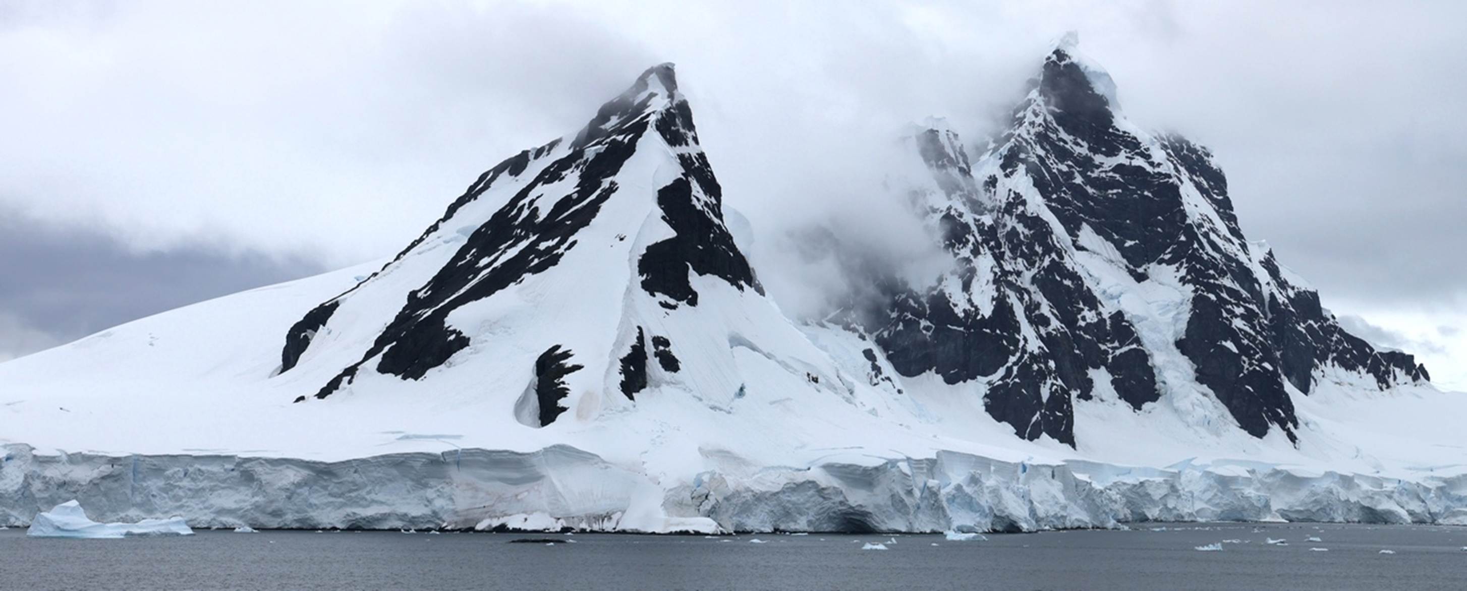
This was the view out our balcony window when we woke up: not bad.

Icebergs, lots of icebergs.

More icebergs, and the glacier they probably came from.

Most of us lined the rails of the middle deck for a better view.
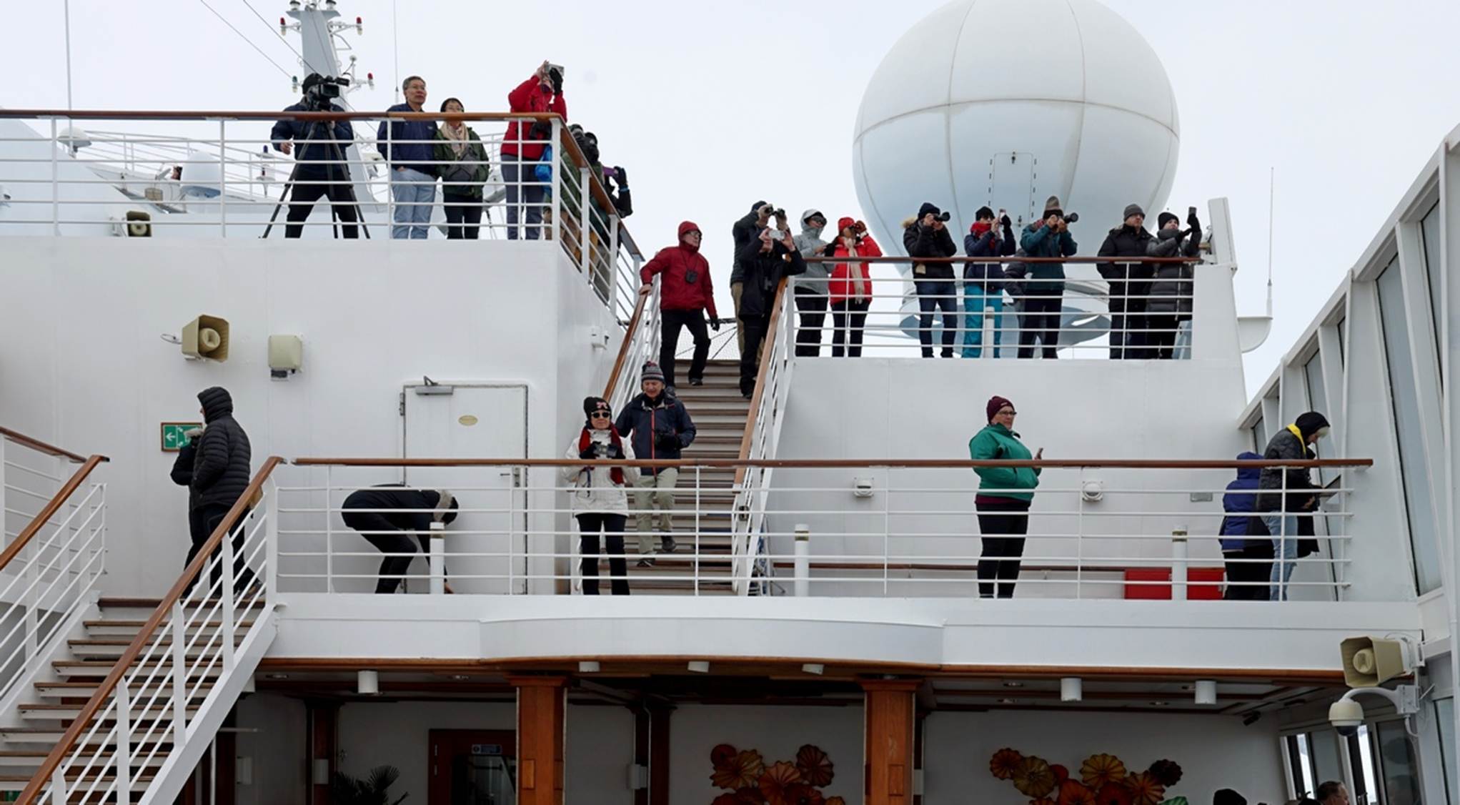
Some people took to the upper decks. Note that everyone above is looking in the same direction: there must be something interesting out there.

In this case, those black specks on the large iceberg are not penguins.

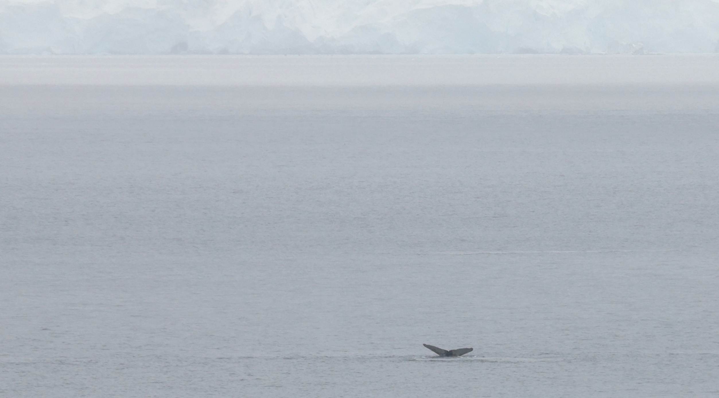
There were a few whales in Paradise Bay, but very few.
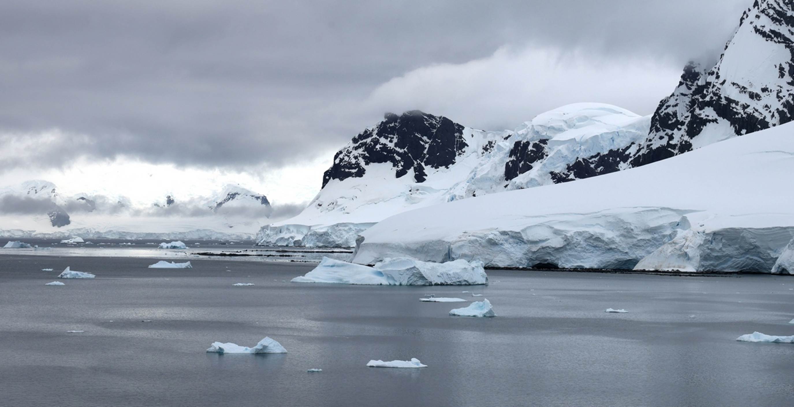
The weather was looking threatening, but thankfully, it held off, although cloudy almost all day.

There are a few penguins on the chunk of ice and some more in the water at the very bottom of the photo.

On the small iceberg to the left there are about 20 penguins.
A whale and two groups of swimming penguins being very respectful

Under all that ice and snow, there is actually lots of rocks and dirt.

Now, here is a somewhat unusual iceberg: makes you wonder just what caused that shape.

Our onboard Antarctica experts referred to this as a “Serrated Iceberg”, but gave no information as to what caused it.

See that black blob on the nearer ice chunk? That is a “Crabeater Seal”, although they actually eat krill, not crabs.


Another unusual iceberg shape

A Viking cruise line expedition ship. If you look close, you can barely see one of their Zodiac inflatable boats a couple of hundred feet in front of the ship. But notice the texture of the white background: that is a mountain back there, not a white cloud.

And here is another expedition ship (cruise line unknown) with a Zodiac off to one side of it. Notice how small the ships are in comparison to the snow and mountains behind them.
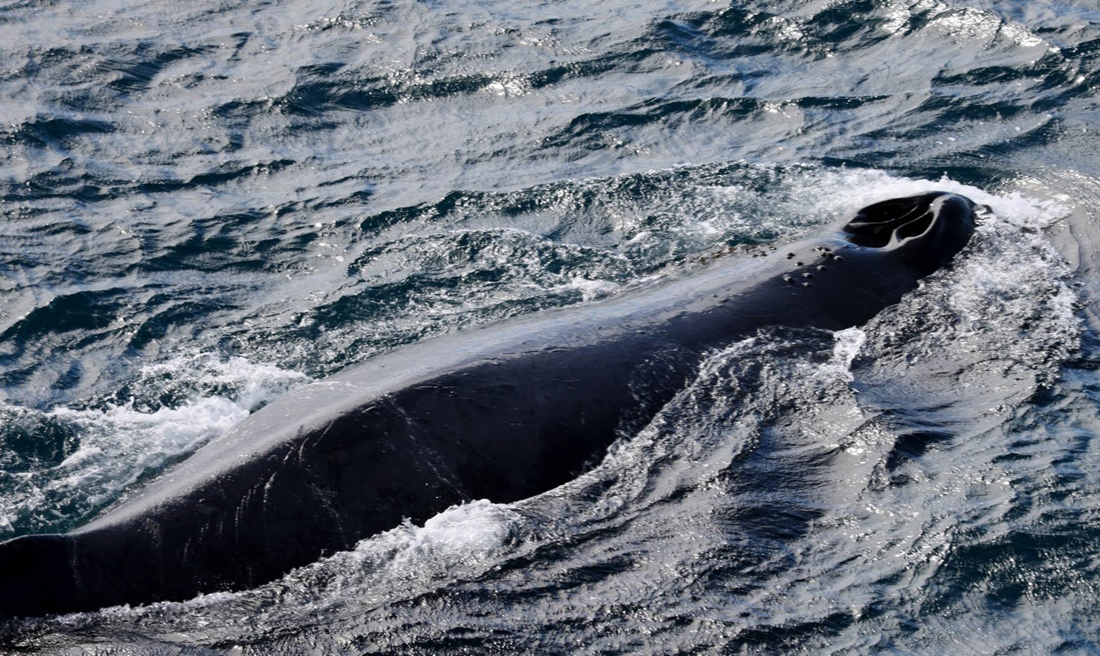
This slightly unusual photo of a whale requires some explanation. We were in our cabin about mid-afternoon when the spotters on the bridge announced “Whale on the port side, 9 o’clock”. I grabbed my camera, went out on our balcony and started scanning for a whale, assuming that it would be well out in the distance. I was about to give up and go back inside when I heard the now familiar loud “Whoosh” very close to me. When I looked almost directly below me, the whale was right there: it could not have been more than 20 – 30 feet from the ship and almost right under our balcony. I clicked off several photos, including the one above where it is still inhaling. I suspect this is the closest I will ever get to a whale in the wild.

Our team of Antarctica experts

I had to get this photo in because it is about the only one from this day that actually had some blue sky. Thankfully, it was providing a good forecast for tomorrow morning.
There was another enrichment presentation this afternoon, “By Endurance We Conquer: Shackleton and his Men” and a movie about Antarctica and many of the animals that live there. We made the presentation, but skipped the movie. Unfortunately, Susan was starting to come down with the same symptoms that I had. Tonight, we had reservations at Polo Grill so I had to have my prime rib again, with a big lump of horseradish on the side. As usual, I could not quite finish it. The entertainment was a couple, dancing/demonstrating the Tango. The dances were supposed to show a history of the tango but were so stylized that they were hard to recognize as the Tango. There were also rather extended video segments (showing parts of Argentina) while the dancers changed costumes. We made it about halfway through the show and gave up. A glass of cognac in the Horizon lounge seemed much better.
During dinner the captain had announced that we would be modifying our schedule for the next day slightly. There was a storm approaching the area and the captain wanted to get started away from there early so we would be at our next site, Half Moon Island, a little early: 6:00 AM, and would cruise the area for two hours, leaving by 8:00. If we wanted to get a good look at what should be some beautiful seascapes, we would have to get up early.
Saturday, Jan 3: Half Moon Island, Antarctica
Half Moon Island is in a bay between two islands, Livingston Island and Greenwich Island, in the Southern Shetland Islands. We were in Admiralty Bay, in the Northern Shetland Islands two days ago. Susan and I got up and made it out on deck by about 6:30 and I immediately thought “Now, this is what we came to Antarctica for”. The sun was shining, the sky was a beautiful blue, we were surrounded by snow covered mountains on almost all sides, and we were in a protected bay with calm water and plenty of icebergs. When you see pictures of Antarctica, this is what you see: you don’t see pictures of clouds and fog covered mountains with little visibility, you see pictures like the beautiful view we had this morning.
I didn’t realize it at first, but Half Moon Island is a relatively small island in the bay that has hills on two ends and is low and flat in the middle. The two black hills in the photo above are the hills at the two ends of the island. We will go around the island before we are done here. For a look much of the way around the bay, you can check this video and get an idea of the mountains surrounding the bay and island. Half Moon Island is centered in the video image at about the 14 second point. Or, you can look at the time lapse video of the bay: you won’t see much of Half Moon Island in the time lapse video because our cabin, where I set up that camera, is on the port side of the ship, and we circled the island, keeping it on our starboard side.

Although Half Moon Island was the official point of interest, the snow and ice covered mountains almost all around the bay are what caught my attention.

There were several icebergs, including one rather unusual “Spike Iceberg”.

In the photo above, that is part of Half Moon Island on the left side.
There are some very low parts of the island which can get covered in water at high tide.

Look closely and you can see the red roof of a couple of buildings of the Camara Base, occupied some summers by the Argentina Navy and some researchers. That is actually a good sized two story building, so it gives you a scale to appreciate the size of the hills on the island.

Coming around the back side of one of the hills, we start to see some animal life. Penguin lovers, we have not forgotten you!

You can easily see the black dots in the snow, mostly Chinstrap Penguins. The yellow line in the snow is their favorite path from the beach to the upper rocky area that they prefer for nesting. Also check the nearest rocks and you can see penguins clustered in several areas.

The early morning light did finally provide some color in the sky. Sunrise was about 5 AM and sunset just before midnight. The Antarctic Circle is still about 5 degrees and a couple of hundred miles south of us.

Look at the sheer cliff of ice and snow on the lower left: you have to wonder just how thick that layer of ice and snow must be, probably several hundred feet.

An expedition ship came into the bay and headed toward the island. They were probably going to use their Zodiacs to visit the island and get a closer look at the penguins.

It is time to leave if we are going to stay ahead of that storm. It has been a beautiful couple of hours.

One last look as we leave the bay.
Once we have left the bay and everyone has had a chance to get some breakfast, there is one last activity to be accomplished while we are in Antarctica: The Penguin Polar Plunge. No, no ice-cold water involved, just whatever temperature the pool water is (someone reported something like 68F). Participants only had to jump in, fully immerse, swim, or paddle to the other end, and climb out. There were about 25 volunteers and the photo below shows the first one, just as his toes were entering the water. You can see the other participants around the pool in their swim suits and robes.

The first of the Penguin Polar Plunge participants
Dinner tonight was in the GDR and we shared a table with two other couples. The meal was mostly memorable for the very poor Red Snapper entrée I had: the filet had a boney like gristle through much of the filet, making much of it inedible. After dinner we had the usual cognac in Martinis, followed by the show for the evening. Tonight, the Marina Production Company vocalists were presenting “Broadway in Concert”, songs from various plays/musicals, many of which I had never heard before.
Since you have made it this far in my rambling Antarctica report, I will now give you the short-cut version. For a “slide show” of photos and videos I took while in Antarctica, check My Antarctica Video. Fair warning, it is 6 minutes long. I suggest watching it in full-screen on a decent size device to get the full effect.
Or, if you want an even shorter look at Antarctica, the “Antarctica experts” on the cruise pooled their photographs and videos and had an experienced video editor put together their “slide show”. I will admit that it is a bit more polished than mine and they had some videos/photos that I did not get (like the Orcas I was not on deck to film). Here is the Oceania Antarctica video.
If you prefer to use direct links to Youtube, you can use these:
Oceania Marina Video: https://youtu.be/2AURweCACTE
Mike’s video: https://youtu.be/bn3vxefJfVE
You can either click on the “Back Button” to go back to the main page, or click on:
Chapter 5 - the cruise continues